
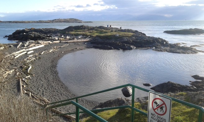
Kitty Islet Park is in the seaside community of Oak Bay, one of thirteen areas of the Capital Regional District of British Columbia. Venture onto the glacial smooth granodiorite outcropping that projects into Enterprise Channel when you visit this promontory. Located on the eastern shore of McNeill Bay, the half a hectare parkland is a nature developed park with a staircase that leads to a rough footpath. A monument notes a dedication to this site that was once called Tliwaynung, a Songhees seasonal site. The fifteen step concrete staircase leads to cobble and sand beach. The pair of Adirondack chairs, placed on the outcropping, provides a seat for a priceless view of the Strait of Juan de Fuca of the Salish Sea. The backdrop is formed by the Olympic Mountains in Washington State. Trial Islands with the lighthouse built in nineteen o six are about one hundred meters away. It is the deep water and tidal currents of Enterprise Channel that limit access to the ecological reserve. Andersen Hill Park, Walbran Park, Monterey Middle School Green Space and Lafayette Park are nearby.
Geographic Location N48º 24’ 38” W123º 18’ 25”
Kitty Islet Park can be reached from the Trans-Canada Highway. Continue along the Hwy 1 into Victoria as it becomes Douglas Street. Turn off Douglas onto Hillside Avenue to head east. Stay on Hillside Avenue as it becomes Lansdowne Road. Continue along Lansdowne Road to reach Foul Bay Road. Continue along Foul Bay Road to reach Fairfield Road. Turn left onto Fairfield Road and continue to Beach Drive. Turn left onto Beach Drive and look for the islet across the bay. Street parking is available. A couple of city buses provide access near Lafayette Park.
