
Juan de Fuca Provincial Park is west of the seaside community of Sooke, one of thirteen communities that form the Capital Regional District of British Columbia. The Juan de Fuca Trail, within the park, lies along the northern side of the Strait of Juan de Fuca and the south western end of Vancouver Island. This popular forty seven kilometer trail is remote and isolated and awareness of weather and tides in the local area will make your hike far more enjoyable. As part of the Juan de Fuca Electoral District, the parkland is maintained by the province of British Columbia. This park became a provincial park in nineteen ninety six when it incorporated the four smaller trail access points to form a continuous shoreline hiking trail. The park covers 1,528 hectares of second growth forest as selective and clear-cut logging as occurred over the past one hundred years. This is linear park that permits access along a narrow strip of the shoreline. There are several areas where the parkland encompasses the valleys and ridges of eighty creeks that flow through this park in to the Pacific Ocean. Visit each of the four main beaches and creeks, China, Sombrio, Parkinson and Botanical, to experience the diversity of waterfronts and the views along the strait.
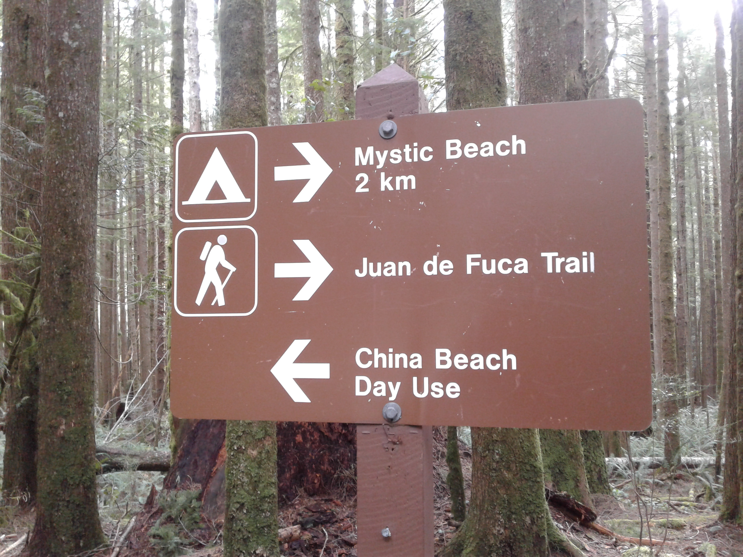
China Beach has a day use area and campground. China Beach hosts an expansive sand and cobble beach. The footpath access from the parking areas is along a wide trail to a ridge. There is a viewing platform to soak up the awesome views of the distant Olympic Mountains in Washington State and the waters of the Strait of Juan de Fuca. The trail descends from the ridge to the beach. The beach is a long curved indentation. The waters are chilly and provide for a refreshing swim. The vehicle accessible campsites are in a second growth forest. You can reserve a site or just show up; do check the BC Parks website).
There is also parking available for hikers who want to head to Mystic Beach or further west along the Juan de Fuca Trail. This is a popular area with day hikes whom stroll the two kilometers to Mystic Beach. The trailhead has outhouses while the trail has a suspension bridge and a variety of terrain through the thick forest. Mystic Beach has an ephemeral waterfall and, at the right tide cycle, a good size sand and cobble beach. Please note that you do not hike down to China Beach to reach Mystic Beach. The trail to Mystic Beach starts right from the day use parking area. The shoreline is not passable, with ease.
The entire trail is forty-seven kilometers of wilderness. This is a vigorous hike that can be done over a long weekend with planning for tides and weather. All sections can be day hiked using the four access points. The Mystic Beach is well trodden as it the area near Botanical Beach.

Sombrio Beach has a river near it and is a well-used hike-in camping area. This is a good surf area and is frequented year around by local surfers. This popular area has a smaller camping area near its sand and cobble shoreline. There are three wilderness areas East, Main and West Sombrio. Parkinson’s Creek is about nine kilometers west; while China Beach is about twenty nine kilometers east.
Parkinson Creek Trailhead is has a parking area and signage for the Juan de Fuca Trail. Camping is available at Payzant Creek about two kilometers westward or at Little Kuitshe Creek about five kilometers to the east. This is an easy push-off location to day hike the trail to Botanical Beach which is about 10 km along the route. The trailhead is a forested area about four kilometers from highway 14.
Botanical Beach is about two hours from Victoria. There is a large parking area. This is a day use area and start of the Juan de Fuca Trail. Botanical Beach is well trodden and is just lovely. There are two trails to the rocky cobble and sand shoreline. Take the one on the east side to access the JdF Trail while the west trail connects to the beach and shoreline trail. Come visit at lowest low tides to see some unusually fun sea organisms. Be very wary of the waves and the slippery rocks. At lower tides try to spot the brown algae that is commonly called the sea palm. It does look like a miniature palm tree.
Geographical location N48º 23’ 15” W123º 44’ 20” at China Beach parking area.
Juan de Fuca Provincial Park can be reached from the Trans Canada Highway. Take the Langford Parkway exit and follow along to reach Sooke Road as it becomes West Coast Road (both are Hwy 14). Its about an hour or so from Victoria. This park is well signed and is access after you pass Jordan River Regional Park and Camping at Jordan River. Look for the exit to the day use area or general parking. There is a good amount of parking at China Beach Park and it often overflows along the highway. This is the western most end of the Juan de Fuca Park. There is parking at Sombrio Beach, Parkinson Beach and Botanical Beach which are 29, 37 and 54 kilometers respectively from China Beach.
A couple of books are available about on hiking this trail. Many are useful as reconnaissance before your trip. Start with the BC Parks website:
