
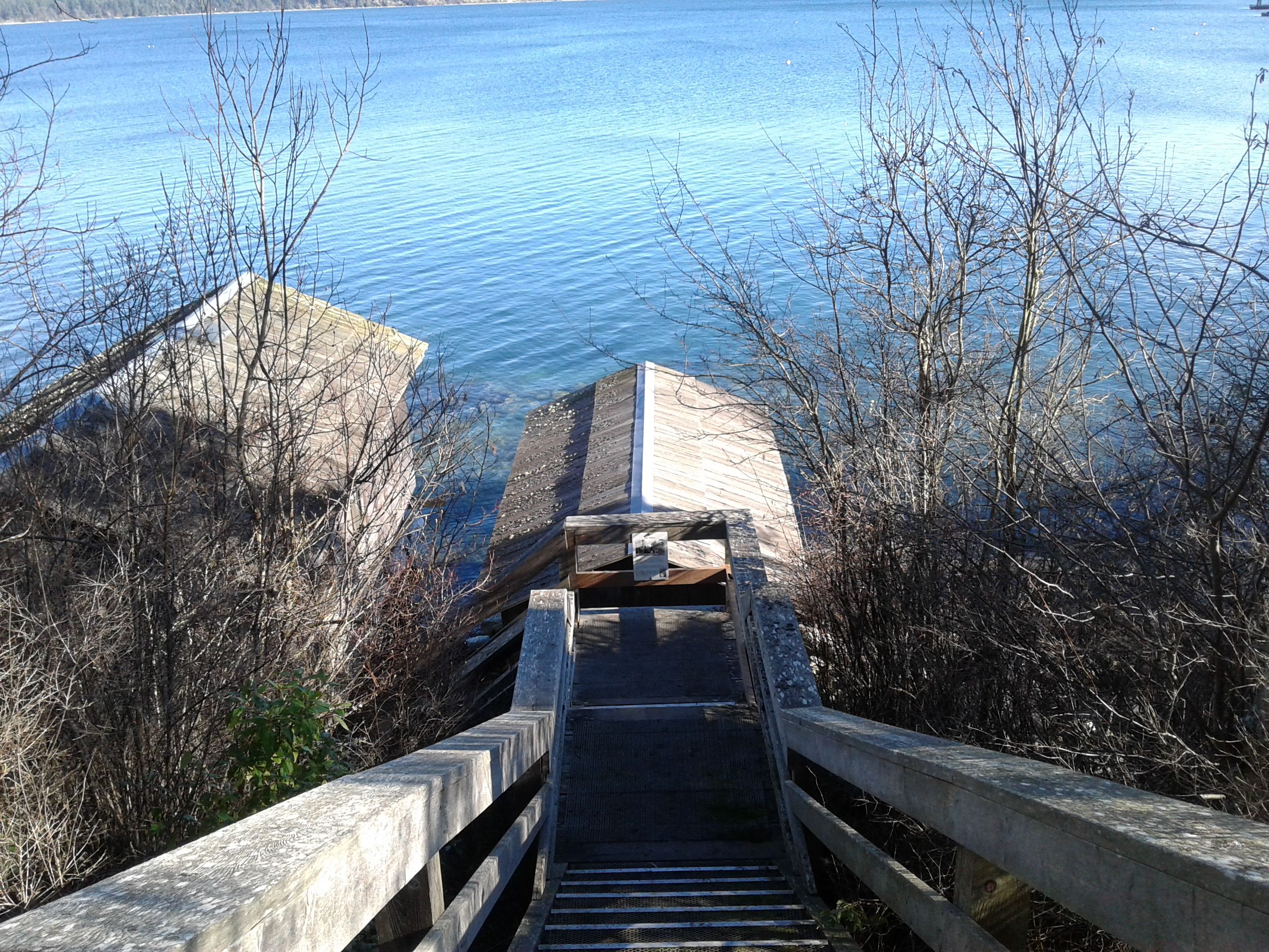
Newman Park lies in the municipality of Central Saanich, one of the thirteen which form the Capital Regional District of British Columbia. Located on the Saanich Peninsula of Vancouver Island, this park is composed of three distinct areas and was formed from the farmland of the Newman Family who established a farm in eighteen ninety seven. The lands may likely had prior usage by the Twasout Nation as a seasonal and periodic outpost. The property has historical heritage significance and is about 1000 meters long and seventy meters wide; divided by the Pat Bay Highway, Central Saanich Road and Wallace Road. The six and half hectare land was donated as a park and agricultural land to the community in twenty o’six. The main parkland provides access to the rocky shores of Cordova Channel. The view across the waters of Cordova Channel at James Island and the Cascade Mountains of Washington State in the United States. This park has a wood chip pathway along its perimeter and an open grass field in the main area. There is a staircase to the beach with a twenty step then ten step staircase. The rocky shoreline is best accessed a lower tides if you want to stroll along the beach. Launching boats is likely better at high tides. Two boat houses contain the racing canoes for a local canoe group. The other two areas of this park are managed with Central Saanich and Farmlands Trust to grow fruits and vegetables for donation. A small sheep farm also resides on the property. The cabin, built in the late eighteen eighties, and the house, built in the early nineteen hundreds, were homes for Nestor Newman and his family. The Victoria &Sidney Railway, one of three railways that traveled the Saanich Peninsula, ran close to these buildings when they were initially built. Wallace Drive is along part of the railway line. There is limited access to the agricultural areas while the shore side park is a great place for a walk in your back yard.
Geographical location N48º 36’ 6” W 123º 23’ 45”
Newman Park can be reached from the Patricia Bay Highway, Highway 17, which heads north from the Trans-Canada Highway (Highway 1). Exit the Highway 17 right onto Mount Newton Cross Road and turn right immediately onto Lochside Drive. Look for the gravel parking area of Newman Park on the right. A split cedar fence provides a barrier for the parkland. City buses travel along Lochside Drive. The agricultural areas of the parkland can be reached from Wallace Drive and Central Saanich Road.
Further information about area can be found with Victoria&Sidney Railway at https://www.victoriaharbourhistory.com/transportation/rail/esquimalt-nanaimo-railroad-2/
And the Farmlands Trust (farmlandstrust.org) and from Visitor In Victoria https://visitorinvictoria.ca/newman-farm-park/ and view some photos at https://www.brakelightfoto.com/Victoria-BC-1/Parks/Newman-Farm-Park/
