Macaulay Point Park is in the seaside community of Esquimalt, one of thirteen communities that form the Capital Regional District of British Columbia. Macaulay Point Park is adjacent to Fleming Bay Park and Buxton Green Park that provides the breakwater to protect the beach and wharves. The park is about seven and half hectares and was leased from the Department of Nation Defense. In nineteen eight five it became a municipal park for Esquimalt.
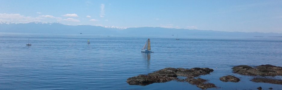
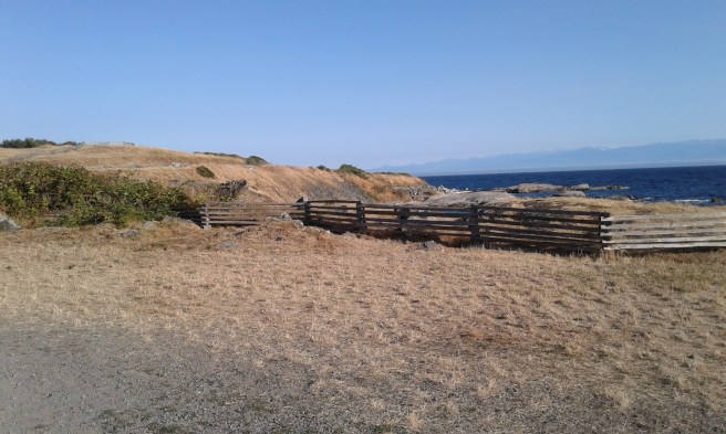
Come out to take in the terrific views of Victoria and the Olympic Mountains across the Juan de Fuca Strait. Come to explore the abandoned gun emplacements and the maze of trails. There are also remnants of the oldest coastal defense battery in British Columbia from four thousand years ago. The trails are either paved or covered by loose gravel and lead along the water front past the concrete defense battery, bunkers, lookouts and storage buildings. This property was originally used by the local people as lookout point that was accessed from Fleming Bay. Seasonally fished using a reef net system to capture salmon, the Lekwungen people used this area prior to it being used for agricultural and military purposes. The Royal Museum of British Columbia has further information on the cultural changes in this area. The land was also once part of the Viewfield Farm and Hudson Bay Company. The bailiff or manager in eighteen fifty was Mr. Macaulay, a Scotsman, whom managed the lands. The point would be renamed to honor him as it was initially called Sailor Point and Mukwuk. The geological rocks are mostly intrusive granodiorites perhaps from the Devonian Paleozoic eras. The rocks show glacial striations and presently have several trees and shrubs where soil was deposited. Garry oak, arbutus, Douglas fir and trembling aspen trees provided stability to the soils. The split cedar fencing lines many of the pathway to limit access to the meadows that host rare plant and animal species. These rare species include dense flowered lupine, foothill sedge and coast microseris. Wild onion, biscuit roots, roses and gumweed can be found as well as plantain, cat’s ear and various grasses. This park is frequented by hikers, dog walkers, runner and walkers. There are many benches along the pathways to stop and enjoy the surroundings.
Geographical Location N48º 25’ 7” W123º 24’ 41”
Macaulay Point Park can be reached from the Trans-Canada Highway (Hwy1). Exit onto Tillicum Road to head south. At the junction with Craigflower Road continue along as the road curves to become Lampson Street. Follow Lampson to Munro Street. Turn left onto Munro Street and look for the parking lot on the left. Two large anchors gate Fleming Bay parking area. Follow the pathway past the docks and green to reach the parkland of Macaulay Point. The park can also be accessed from Clifton Terrace from Munro Street. The closest bus travels along Lampson and Munro streets.
Further Information
Royal BC Museum write up about Fleming Bay and Macaulay Point http://staff.royalbcmuseum.bc.ca/2016/12/21/the-archaeology-and-history-of-macaulay-point/
Management Plan for Macaulay Point Natural Area https://www.esquimalt.ca/sites/default/files/docs/parks-recreation/2009_macaulay_point_natual_areas_mgmt_plans_report_mar_2009_final_draft.pdf
Explores Guide to BC Lighthouses
Secret Beaches of Greater Victoria
