
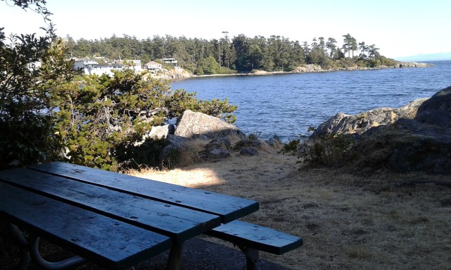
Denniston Park is in the seaside community of Esquimalt, one of thirteen communities that form the Capital Regional District of British Columbia. With a view over the Saxe Point, Strait of Juan de Fuca, and Royal Roads Bay, this granite rok headland is an inspiring place to take a stroll. The asphalt pathway from the south end of Grafton Street leads past a small grass covered area bordered by a chain link fence. A couple of picnic tables can be found before reaching the view point. It is not easy to access the water from this park. The concrete storm drain easement has a chain link fence barrier to prevent access. The park lies at the end of Grafton Street. The street was named to honor the H.M.S. Grafton a flagship of the Pacific Station that was launched in eighteen ninety two. The name of the park maybe related to long term residents of the street or to Canadian art Stan Denniston. Saxe Point Park, Freeman Ken Hill Park and Foster Park are nearby.
Geographical Location N48º 25’ 42” W123º 25’ 23”
Denniston Park can be reached from the Trans-Canada Highway (Hwy1). Exit onto Admirals Road to head south. At the junction with Craigflower Road continue along as the road curves to reach Esquimalt Road. Turn right onto Esquimalt Road and continue along to Grafton Street. Turn left onto Grafton Street and continue to the end of road. There is limited street parking. Buses travel along Esquimalt Street

I was wondering if the park was named after Drew Denniston who lived in the house at the start of the park and who died far too young?
That is possible. Perhaps the family was able to donate land in his memory. I did not find information about the naming the parkland.